Machu Picchu
5 km away
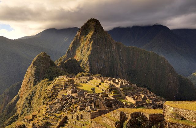
Machu Picchu is the 15th-century Inca estate on a ridge 2,430 metres above sea level, between the peaks of Machu Picchu…
308 tickets & tours
Ancient City · Andean · Peru
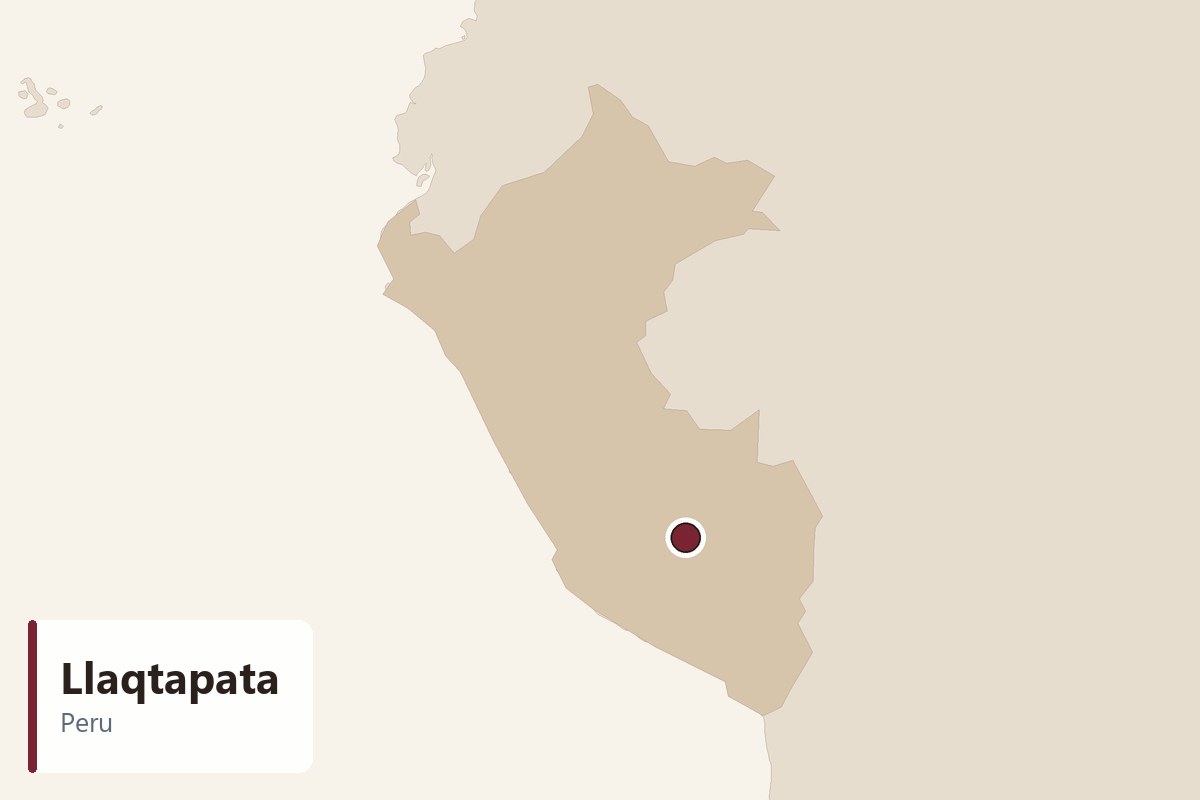
Llaqtapata is an Inca site on a forested ridge about 5 km west of Machu Picchu, reached only on foot by a steep trail above the Santa Teresa valley. Hiram Bingham first reported it in 1912, but it was properly mapped only in 2003. Most people see it on the last day of the Salkantay trek, for its distant view of Machu Picchu.
Nothing is sold online for Llaqtapata on its own. There is no ticket office, no fence and no road: the ruins lie on the trail, and you visit them simply by walking there.
Almost everyone comes on a guided Salkantay trek from Cusco. The usual four- or five-day route crosses the high pass below Salkantay mountain, descends through cloud forest to the Santa Teresa area and then, on the last trekking day, climbs from the coffee farms of Lucmabamba over the Llaqtapata ridge before descending to Hidroelectrica and walking along the railway to Aguas Calientes. Trek prices normally include the guide, camping or lodges, meals, mules for bags and the return train or bus, while the Machu Picchu ticket may or may not be included, so check.
Independent hikers can do the same walk from Santa Teresa with a local map or a guide hired in town; the path is clear in the dry season but steep, and there is little help on the way. Some lodge-to-lodge versions of the trek stay near Llaqtapata for a night.
For most people the sensible choice is a reputable Salkantay trek that keeps the Llaqtapata day rather than taking a shortcut by vehicle to Hidroelectrica.
The walk starts among coffee, banana and avocado farms at Lucmabamba in the valley above Santa Teresa, and climbs steeply through cloud forest on an old Inca path. Several farms sell coffee and fruit on the way up. Allow about three hours for the ascent, with stretches of stone steps and roots that are slippery after rain.
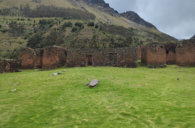
Near the crest the trail reaches the main group of buildings, partly cleared from the forest: stone walls, house compounds, terraces and water channels spread along the ridge. One long building faces east towards Machu Picchu and is thought to line up with the June solstice sunrise. Much of the complex remains under vegetation, so look for walls among the trees.
Live prices from GetYourGuide for tickets and tours that include this site. Free cancellation on most of them.
Just beyond the ruins, a clearing on the ridge looks east across the Aobamba valley to Machu Picchu, Huayna Picchu and the zigzag road climbing to the citadel. It is a distant view, so binoculars help. Clouds often fill the valley by late morning; if they lift, this is one of the few places to see the site from the side.
From the ridge the path drops steeply for about an hour and a half through forest to the Aobamba river and the hydroelectric station. From there a level path follows the railway along the Urubamba to Aguas Calientes in about three hours. Water and snacks can be bought at small stalls near Hidroelectrica.
Llaqtapata was built by the Incas, probably in the 15th century, when Machu Picchu was laid out as a royal estate. It stood on a branch of the Inca road network that ran from Machu Picchu west into the Vilcabamba region. Hiram Bingham passed it in 1912 and noted ten or a dozen buildings and a local name meaning an elevated town, but he did not study it. Seventy years and more went by before a survey led by Hugh Thomson and Gary Ziegler in 2003 mapped a much larger complex. They suggested that it served as a roadside shrine and resting place on the approach to Machu Picchu, with an astronomical role at the solstices.
Llaqtapata can only be reached on foot. The nearest town is Santa Teresa, about five to six hours by road from Cusco via the Abra Malaga pass; colectivos leave from Cusco for Santa Maria and Santa Teresa daily. From Santa Teresa a short taxi ride takes you to Lucmabamba, where the trail climbs to the ruins in about three hours. On the far side, the path descends to Hidroelectrica, where trains leave for Aguas Calientes and minibuses return to Santa Teresa and Cusco. The nearest airport is Cusco, which has frequent flights from Lima. There is no parking at the site; leave vehicles in Santa Teresa or Lucmabamba.
Treat the ruins with care: do not climb on walls, move stones or camp inside the buildings. Drones are not permitted near Machu Picchu and its protected area. Carry plenty of water, snacks, sun protection, insect repellent, a rain jacket and proper walking boots with grip. There are no toilets or services at the ruins themselves, so use the farms and lodges along the trail and carry out all your rubbish.
The dry season from May to September is the best time: paths are firmer, skies clearer and the view across to Machu Picchu more likely to be open. June, July and August are also the busiest months on the Salkantay trek, and campsites near the route fill up. The rainy season from December to March brings mud, slippery steps and frequent cloud, and the Inca Trail itself closes in February, which pushes more hikers onto alternative routes.
On any day, aim to reach the ridge by mid-morning. Cloud rises from the valleys as the day warms, and by midday the view is often lost. Most trek groups leave Lucmabamba at dawn for this reason. Allow a full trekking day from Lucmabamba to Aguas Calientes, of which about an hour is spent at the ruins and the viewpoint.
The obvious pairing is Machu Picchu itself, visited the next morning from Aguas Calientes after the walk along the railway from Hidroelectrica. In Santa Teresa, the hot springs of Cocalmayo are a popular rest after the trek. The Inca site of Choquequirao and the Vilcabamba ruins lie further west and need several more days on foot.
5 km away
Machu Picchu is the 15th-century Inca estate on a ridge 2,430 metres above sea level, between the peaks of Machu Picchu…
308 tickets & tours
36 km away
Ollantaytambo is an Inca royal estate and fortress at the western end of the Sacred Valley, 2,792 metres above sea…
87 tickets & tours
38 km away
Pumamarca is an Inca site of terraces, storehouses and stone enclosures on a ridge above the Patacancha valley, north…
2 tickets & tours
| Hours | No set hours; walk it in daylight and allow time to reach Hidroelectrica |
|---|---|
| Closed | Open daily; trails may be muddy or closed after heavy rain |
| Entry fee | No ticket office at the ruins |
| Time needed | Half a day on foot, with the climb |
| Best time | Morning, before cloud rises; May to September in the dry season |
| Booking | Nothing to book for the site; trek operators include it on the Salkantay route |
| Access | Steep, rough, often muddy trail with a long climb; no wheelchair or pushchair access |
| Getting there | Trail from Lucmabamba near Santa Teresa, about 3 hours uphill; or from Hidroelectrica |
| Founded | 1450 (15th century (midpoint), Inca) |
| Civilisation | Andean |
| Checked | October 2026 |
No set hours; walk it in daylight and allow time to reach Hidroelectrica. Open daily; trails may be muddy or closed after heavy rain.
Entry fee: No ticket office at the ruins.
Allow Half a day on foot, with the climb for Llaqtapata.
Nothing to book for the site; trek operators include it on the Salkantay route.
Yes. GetYourGuide sells tickets and guided tours whose route includes Llaqtapata; live prices are shown on this page.
Morning, before cloud rises; May to September in the dry season.
Trail from Lucmabamba near Santa Teresa, about 3 hours uphill; or from Hidroelectrica.
Steep, rough, often muddy trail with a long climb; no wheelchair or pushchair access.
Worth it for trekkers wanting a quiet Inca ruin and a side view of Machu Picchu. Skip it if you are not walking the Salkantay route or are short of fitness, since there is no road access.
Llaqtapata dates from 1450 (15th century (midpoint), Inca).